Take a look at the history of Budapest from prehistoric times to the present day

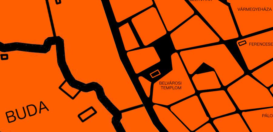
In our latest ATLO data visualisation, we show you how Budapest has evolved. From the prehistoric times through the reign of the Celts, the Romans, the Middle Ages and the Modern Age to the present, you can follow what colonies, villages and towns in what is now Budapest have disappeared over the centuries, or how Pest, Buda and Óbuda finally merged in the 19th century.

You can learn from our interactive feature that there was a Celtic fortress on Gellert Hill before the arrival of the Romans, that in the Middle Ages Kispest was located on the Buda side, and that there was a Vienna near what is Deak Square today. Logodi Street, Kőér Street as well as Gubacsi Street, also represent villages that have since disappeared.

Infographic: Atlo.team
Click here to browse our full feature:
Budapest várostörténete az őskortól napjainkig
BUDAPESTAZ ŐSKORTÓLNAPJAINKIG Budapest területén az őskortól kimutathatók az emberi letelepedés nyomai. Ebben az anyagunkban az mutatjuk be, hogy az 1950. január 1-én megalakult, a jelenlegi közigazgatási határokat rögzítő Nagy-Budapest területén milyen települések voltak az ő
Written by Attila Bátorfy, data visualisation by Atlo.team
Share:
Your support matters. Your donation helps us to uncover the truth.
- PayPal
- Bank transfer
- Patreon
- Benevity
Support our work with a PayPal donation to the Átlátszónet Foundation! Thank you.
Support our work by bank transfer to the account of the Átlátszónet Foundation. Please add in the comments: “Donation”
Beneficiary: Átlátszónet Alapítvány, bank name and address: Raiffeisen Bank, H-1054 Budapest, Akadémia utca 6.
EUR: IBAN HU36 1201 1265 0142 5189 0040 0002
USD: IBAN HU36 1201 1265 0142 5189 0050 0009
HUF: IBAN HU78 1201 1265 0142 5189 0030 0005
SWIFT: UBRTHUHB
Be a follower on Patreon
Support us on Benevity!