Data visualization feature: this is what Hungary looks like from above

The New York Times published a data visualization project last year that examined how the United States looks like from above: structures of streets, buildings, and towns. Inspired by this project Atlatszo’s data team, Atlo, decided to look at what Hungary looks like from above.
I remember my high-school geography textbook. Somewhere at the end of the book, there were pictures of the structures of certain Hungarian towns. I distinctly remember the shape of the town of Hajdúböszörmény: it looked like a haystack.
Today I know that all towns and cities have a structure – and scientists study their shape, that is, their morphology. Atlo’s project looked at the morphology of Hungarian towns.
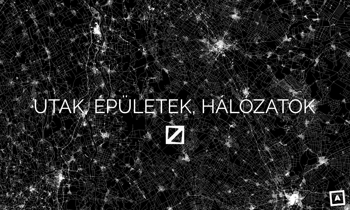
This is the network that Hungary’s roads and towns create:

The structure of roads and towns in Hungary
Our project looks at each of the shapes that characterize urban areas and look at the reasons why towns took that specific shape. We trace their history, provide several illustrations for each of them. We also look at the urban structure of Hungary and you can ’fly’ over Hungary using our interactive map. You can also play our game: try to guess the towns from their shape!

Hajdúböszörmény (Hajdú-Bihar m.)
Our data visualization project is available in Hungarian.
Utak, épületek, hálózatok
Halmaz, szalag, sakktábla. Hogy néznek ki Magyarország települései felülről?
Written by Attila Bátorfy
English version by Anita Kőműves. You can read the original story in Hungarian here.
Share:
Your support matters. Your donation helps us to uncover the truth.
- PayPal
- Bank transfer
- Patreon
- Benevity
Support our work with a PayPal donation to the Átlátszónet Foundation! Thank you.
Support our work by bank transfer to the account of the Átlátszónet Foundation. Please add in the comments: “Donation”
Beneficiary: Átlátszónet Alapítvány, bank name and address: Raiffeisen Bank, H-1054 Budapest, Akadémia utca 6.
EUR: IBAN HU36 1201 1265 0142 5189 0040 0002
USD: IBAN HU36 1201 1265 0142 5189 0050 0009
HUF: IBAN HU78 1201 1265 0142 5189 0030 0005
SWIFT: UBRTHUHB
Be a follower on Patreon
Support us on Benevity!